


After months of relentless sunshine and the severe drought that has gripped much of the nation, the promise of rain is a welcome reprieve. However, as is often the case with British weather, we are moving from one extreme to another, with forecasters now warning of ‘intense’ thunderstorms and heavy downpours that could sweep across England and Wales, bringing their own unique set of challenges Scott. These storms, expected to arrive in earnest, aren’t just a quick and welcome drink for our parched gardens; they are a significant weather event that warrants caution)Skip, particularly for those planning to travel. The shift from dry to wet is dramatic, and the ground and its inhabitants are not entirely prepared for this sudden deluge, making the coming days a period of potential disruption that requires a little extra awareness and preparation.
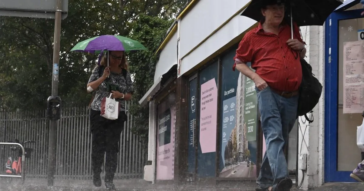
The storm system is set to arrive in earnest, with a band of heavy showers tracking northwards throughout the day on Wednesday. The Met Office has issued a yellow weather warning for thunderstorms that will span a wide swathe of the country, covering London and the South East, the Midlands, East Anglia, and stretching into parts of the North West, South West, and eastern Wales. This isn’t just a light drizzle; forecasters are predicting that some of these showers will be incredibly intense, with the potential for 20 to 30 millimetres of rain to fall in less than an hour. In the most affected spots, that figure could reach 40 to 50 millimetres over a two-to-three-hour period, a volume of water that the hard, dry ground may struggle to absorb. This sudden onslaught of water brings with it the very real risk of surface water flooding, which can quickly disrupt roads and isolate communities, turning familiar streets into temporary rivers.
The core of the concern lies within the very soil itself. The prolonged period of dry weather has left the ground exceptionally hard and compacted, acting more like concrete than a sponge. Under normal conditions, the earth absorbs rainfall, allowing the water to slowly filter down and replenish the water table. However, after months without significant moisture, the top layer of soil has effectively baked, creating a barrier that water cannot easily penetrate. Consequently, heavy rain simply sits on the surface and runs off, leading to flash flooding much quicker than it would after a wetter period. This paradox means that a land desperately in need of water is now significantly more vulnerable to flooding from the very rain meant to save it. The Met Office has acknowledged this, warning of a small risk of flooding that could lead to damage to buildings from floodwater, and even the danger of fast-flowing or deep floodwater posing a threat to life.
Adding a further layer of hazard to the storm is its impact on the roads. While wet roads are a common challenge for drivers, the RAC has issued a stark warning that the driving conditions right now are far more dangerous than typical rainy weather. Throughout the long dry spell, a layer of oil, fuel, and rubber deposits has been building up on the road surface We’re not just seeing rain; we’re seeing a perfect storm of unusual hazards. This invisible coating has been dry, dusty, and largely harmless. But now, as the light rain begins to fall, it acts as a solvent, mixing with these deposits to create a slippery, greasy film on the asphalt. This film dramatically reduces tyre grip, making it much easier for vehicles to skid, significantly increasing the risk of accidents that would not normally occur in simple rainy conditions. Rod Dennis, a road safety spokesperson for the RAC, has urged drivers to become more cautious in light of these conditions, advising them to reduce their speed in rainfall of any intensity and leave extra space between their vehicle and the one ahead to mitigate the risk of collisions.
Beyond the immediate danger on the roads, the sheer intensity of the storms poses other risks. Frequent lightning and large hail are potential hazards that could come alongside the heavy rain. Lightning strikes carry an inherent danger, causing power cuts and potentially damaging property, while hailstones can damage cars, roofs, and quickly cover the ground in a slippery white layer, adding to the treacherous driving conditions. The wind gusts accompanying the storms can also be surprisingly strong, capable of toppling unsecured objects. Recognizing this, the Met Office has advised the public to be proactive and secure moveable objects around their homes and gardens. This includes common items often left out such as bins, garden furniture, trampolines, tents, gazebos, sheds if possible, and fences. A little bit of foresight in securing these items can prevent them from becoming dangerous projectiles in the storm’s powerful gusts and prevent damage to your and your neighbours’ property.
The unsettled weather is not expected to be a fleeting event, either. A second yellow warning for thunderstorms has already been issued for Thursday, covering a similarly large area across the Midlands, East Anglia, North West, Yorkshire, South West, and much of Wales. This means the ground will not have time to dry out, and the risk of flooding will be even more pronounced. The concern escalates from damage to property to a small chance of fast-flowing and deep floodwater causing danger to life. Homes and businesses could be flooded very quickly, and the cumulative effect of two days of intense rain could prove overwhelming for drainage systems. This is not a time for complacency. The transition from a period of scarcity to one of abundance is a stark reminder of the power of nature and the need to adapt quickly to its changes. As we welcome the end of the drought, we must also prepare for the potential dangers that arrive with its conclusion.