



The Stormy Forecast Ahead: How El Niño Is Set to Reshape Britain’s Weather
The United Kingdom is standing at a meteorological crossroads this year, caught between the scorching remnants of an unprecedented summer and the looming threat of a turbulent autumn and winter season. After months of relentless heat that has parched the countryside, depleted reservoirs, and tested the resilience of communities across the nation, the weather is preparing to deliver yet another dramatic shift. The culprit behind this impending transformation is the infamous El Niño phenomenon, a natural climate pattern that has the power to reshape weather systems across the entire planet. As forecasters at the Met Office analyze the data emerging from their sophisticated monitoring systems, they are increasingly concerned about what this particular El Niño event might bring to British shores in the coming months.
The summer that Britain has just endured has been nothing short of extreme, with temperatures shattering previous records and leaving the country in a state of perpetual alert. Heatwaves have rolled across the nation with alarming frequency, transforming the landscape into a tinderbox and pushing the emergency services to their absolute limits. Firefighters have battled back-to-back wildfires in parched grasslands and woodlands, while water companies have struggled to maintain supplies to homes and businesses as reservoirs have dwindled to critically low levels. The infrastructure of the country has creaked under the strain, with roads melting in the heat and railway lines at risk of buckling. Yet despite all of this, the possibility of a sixth heatwave still looms on the horizon before the summer finally draws to a close, and meteorologists are watching the skies with growing apprehension.
Now, with the arrival of El Niño, the weather narrative is set to take yet another dramatic turn. This powerful natural phenomenon occurs every three to seven years, triggered by significant shifts in ocean winds and currents that push warm water across the Pacific Ocean. The result is a cascade of atmospheric changes that ripple across the globe, altering rainfall patterns, temperature distributions, and storm tracks in ways that can be both profound and unpredictable. In the tropical eastern Pacific, sea surface temperatures are expected to rise by more than three degrees Celsius above their long-term averages in the coming months, a figure that has shocked even seasoned forecasters at the Met Office. This represents a warming signal of unprecedented intensity, one that dwarfs anything recorded in recent memory.
Professor Adam Scaife, the head of long-range forecasting at the Met Office, has described this development in remarkably stark terms, acknowledging that he has never witnessed an El Niño signal of this magnitude in all his years of professional forecasting. The typical El Niño event brings a temperature increase of one to two degrees Celsius in equatorial Pacific waters, which itself is considered a major climatic event. The fact that current projections suggest we could see a warming of more than three degrees places this phenomenon in a category entirely of its own. The implications of such an intense signal are far-reaching, promising to significantly exceed our recent experience of El Niño and its worldwide climate influences. It suggests that the coming months will bring weather patterns that could challenge our infrastructure, our emergency services, and our very way of life.
For the United Kingdom, the arrival of this powerful El Niño carries specific and concerning implications. While tropical regions face the prospect of severe drought, and areas such as southern Africa and north-eastern Australia brace for water scarcity, the prediction for north-western Europe tells a different but equally challenging story. The forecast indicates that Britain should prepare for wetter and stormier conditions as autumn transitions into early winter. This represents a dramatic swing from the current parched conditions, one that could bring its own set of challenges and dangers. The sudden transition from drought to deluge is particularly problematic, as the hard-baked ground is ill-equipped to absorb large volumes of water, leading to the very real risk of flash flooding in vulnerable areas.
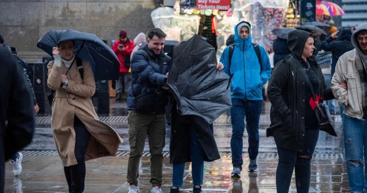
The immediate effects of this shifting weather pattern have already begun to manifest themselves in sudden, violent downpours that have swept across parts of the country. Lancashire experienced its wettest conditions in recent memory as more than fifty millimetres of rain fell in a single day, a remarkable figure considering that this represents roughly a third of the total rainfall typically expected for the entire summer season. Similar scenes played out in East Sussex, where coastal communities were battered by heavy precipitation in a matter of hours. These dramatic weather events have triggered fresh concerns about flash flooding, as water runs off the dry, compacted ground rather than soaking into it, overwhelming drainage systems and turning streets into temporary rivers. The sudden arrival of this rain, while welcome in some respects, has demonstrated just how vulnerable the country remains to rapid shifts in weather patterns.
The connection between El Niño and global temperature patterns adds yet another layer of complexity to an already challenging situation. Dr Nick Dunstone, a science fellow at the Met Office, has explained that during major El Niño events, significantly more heat is released from the ocean into the atmosphere, leading to a measurable increase in global average temperatures. This warming effect is most pronounced in the calendar year following the winter peak of the El Niño event, which means that next year could break all previous records for global warmth. In fact, projections suggest that 2027 is very likely to replace the current warmest year on record, becoming the first year to consistently exceed one and a half degrees Celsius above pre-industrial levels. This represents a symbolic and practical milestone in our changing climate, one that carries profound implications for ecosystems, agriculture, and human communities around the world.
The human impact of these dramatic weather swings cannot be overstated. The drought conditions that have gripped much of England and Wales have taken a terrible toll on agriculture, with crops withering in the fields and livestock suffering from lack of water and pasture. Wildlife has been pushed to the brink in some areas, with fish dying in shallow, oxygen-depleted rivers and birds struggling to find food and water in the parched countryside. The situation became so severe that the Prime Minister was forced to convene an emergency Cobra meeting to coordinate the national response, with water companies implementing hosepipe bans and other restrictions to conserve dwindling supplies. The prospect of a sudden and prolonged period of wet and stormy weather presents its own set of challenges, from disrupted transport networks to potential damage to homes and businesses from flooding and high winds.
The infrastructure of the country, already weakened by extreme heat, will face new tests in the coming months. The transition from drought to deluge places particular strain on drainage systems and flood defences, many of which may not have been designed to cope with the intensity of rainfall that El Niño events can bring. Roads and buildings that have dried out and cracked during the summer months may be vulnerable to water damage, while the roots of trees weakened by drought conditions could fail in saturated ground, leading to the risk of falling timber in urban and rural areas alike. The National Grid may also face challenges, with storm damage to overhead power lines and substations a real possibility during periods of severe weather.
Climate change is adding an additional layer of complexity to these natural weather patterns, intensifying their effects and making their outcomes less predictable. The warming of the planet as a whole provides more energy for weather systems, making storms more intense, rainfall heavier, and temperature extremes more pronounced. This means that even a standard El Niño event now has the potential to produce impacts that would have been unthinkable just a few decades ago. The combination of natural climate variability and human-induced climate change is creating a new normal in which extreme weather events are no longer the exception but the rule, and in which our systems and communities must learn to adapt to conditions for which they were never designed. The Met Office has been clear that we should expect more of these compound events, where different types of extreme weather occur in quick succession or even simultaneously, placing even greater demands on our responses and resilience.
As Britain looks towards the autumn and winter months ahead, there is a palpable sense that the country is preparing for a period of significant challenge. The sudden rainfall observed in recent days has provided a small taste of what is to come, but forecasters warn that this is only the beginning. The wet and stormy conditions associated with this particular El Niño event could persist for several months, bringing prolonged periods of heavy rain, strong winds, and the very real risk of flooding in areas that have struggled with drought all summer. This will require careful coordination between government agencies, emergency services, water companies, and local communities to ensure that the nation is as prepared as possible for what lies ahead. The vulnerability exposed by the summer’s heatwaves must not be allowed to become a vulnerability to autumn’s storms.
The advice from meteorological experts is clear: we should expect the unexpected and prepare for conditions that may challenge our assumptions about what is normal for this part of the world. The natural weather systems that have governed our climate for millennia are being amplified by the warming atmosphere, creating conditions that push the boundaries of our experience. Whether this autumn and winter will indeed bring the extreme conditions that forecasters are predicting remains to be seen, but the evidence suggests that we should take their warnings seriously. The coming months will be a test not only of our physical infrastructure but also of our collective ability to respond to the challenges of a rapidly changing climate, one that shows no respect for seasonal norms or historical precedents. As the El Niño signal strengthens and the weather patterns begin to shift, the nation watches and waits, hoping that we have learned the lessons of this extraordinary summer and will be ready for whatever the coming storms may bring.