The Impending Threat of Storm Darragh and the Pattern of Recent Severe Weather in the UK
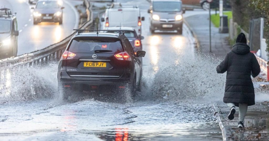
The United Kingdom braces itself for the onslaught of Storm Darragh, the fourth named storm to impact the region in a mere two months, following in the tumultuous wake of Storms Ashley, Bert, and Conall. This succession of severe weather events has left communities reeling from heavy rainfall, powerful winds, and even snowfall, raising concerns about the increasing frequency and intensity of such meteorological phenomena. Storm Bert, in particular, wreaked havoc in South Wales, Worcestershire, and Northamptonshire, leaving homes and vehicles submerged and families grappling with the aftermath of the deluge. Storm Darragh, poised to strike Ireland before sweeping across Wales, England, and Scotland, threatens to exacerbate the existing damage and further test the resilience of communities still recovering from previous storms.
The Met Office, the UK’s national weather service, has issued a trifecta of weather warnings – yellow, amber, and the ominous red "danger to life" alert – underscoring the gravity of the impending storm. Wind speeds are projected to reach a staggering 90 mph, with Wales, Bristol, and other western regions of England bearing the brunt of the tempest. The extreme weather conditions carry the potential for uprooted trees, airborne debris, power outages, and flooding, prompting flood warnings across southern England. Rainfall accumulations of up to 60 mm are anticipated during the storm’s projected four-day duration, further intensifying the threat to life and property.
The underlying cause of this relentless barrage of severe weather, according to Met Office spokesperson Andrea Bishop, lies in a potent combination of low pressure and an exceptionally active west-to-east jet stream with speeds exceeding 200 mph. This powerful jet stream, acting as a meteorological superhighway, is propelling Storm Darragh towards the UK, intensifying its winds and contributing to the predicted disruption. The rapid pressure rise following the storm’s passage further amplifies its impact. While acknowledging the severity of the current weather pattern, Bishop points out that such events are not entirely unprecedented for this time of year, citing previous storms like Debi and Elin in 2023 and Desmond in 2015 that occurred around the same period. This historical context provides some perspective but does not diminish the immediate threat posed by Storm Darragh.
The Science Behind the Storms: Jet Streams and Low-Pressure Systems
Understanding the meteorological mechanics driving these storms is crucial to comprehending their impact and preparing for future events. The jet stream, a high-altitude river of air flowing rapidly from west to east, plays a pivotal role in shaping weather patterns across the UK. Its position and strength influence the development and trajectory of storms. A strong and active jet stream, like the one currently observed, can intensify low-pressure systems and steer them towards the UK, resulting in the severe weather experienced in recent months. Low-pressure systems, characterized by rising air, promote cloud formation and precipitation. The combination of a potent jet stream and a deep low-pressure system creates the perfect storm, literally, bringing strong winds, heavy rain, and the potential for flooding.
The Impact of Climate Change on Extreme Weather Events
While the occurrence of storms in late autumn and early winter is not unusual for the UK, the increasing frequency and intensity of these events raise questions about the role of climate change. Scientists are still investigating the complex relationship between climate change and individual storms. However, there is growing evidence that a warming planet can contribute to more extreme weather events. Warmer sea surface temperatures provide more energy for storms, potentially leading to stronger winds and heavier rainfall. Changes in atmospheric circulation patterns, including the jet stream, can also influence storm tracks and intensity. Further research is needed to fully understand the complex interplay between climate change and extreme weather events, but the current trend of increasingly severe storms warrants careful monitoring and preparedness.
Preparing for Storm Darragh and Future Storms
As Storm Darragh approaches, individuals and communities must take proactive measures to mitigate the potential risks. Heeding weather warnings and staying informed about the storm’s progress are crucial. Securing loose objects outdoors, trimming trees near power lines, and preparing for potential power outages are essential steps. Coastal communities should be particularly vigilant about the risk of high tides and storm surges. Having an emergency kit with essential supplies, such as food, water, and medications, is also recommended. In the longer term, investing in resilient infrastructure and adapting to the changing climate will be crucial to minimize the impact of future storms.
The Need for Long-Term Resilience and Climate Adaptation
The repeated onslaught of storms highlights the need for a long-term perspective on climate resilience and adaptation. Investing in flood defenses, strengthening infrastructure, and developing early warning systems are crucial steps to protect communities from the increasing risks of extreme weather. Furthermore, reducing greenhouse gas emissions to mitigate climate change is essential to address the root cause of these intensifying weather patterns. International cooperation and coordinated efforts are paramount to tackling this global challenge and safeguarding communities from the growing threat of extreme weather events.


