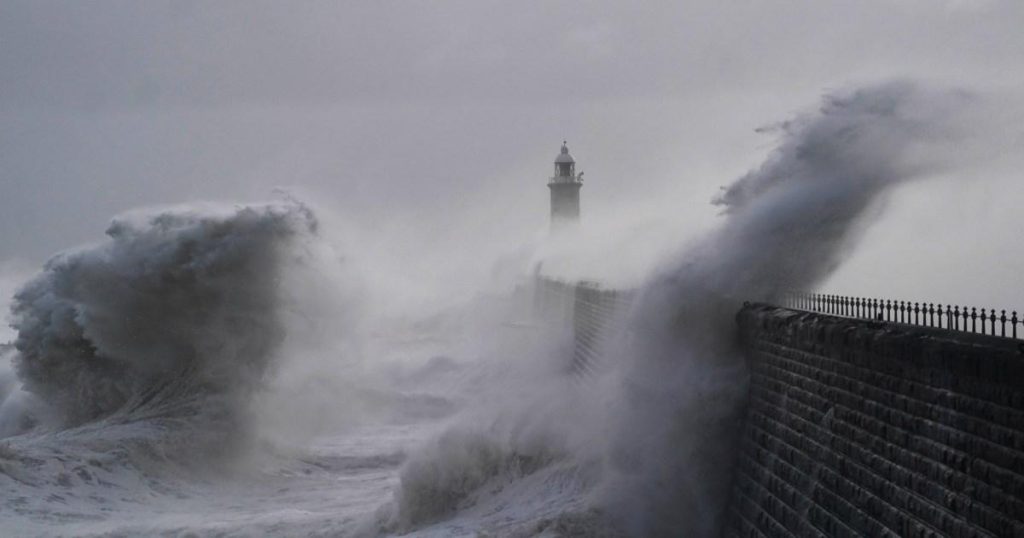
Paragraph 1: UK Braces for Potentially Historic Storm Eowyn
The United Kingdom is on high alert as Storm Eowyn, a powerful weather system, approaches, bringing with it the threat of severe winds, torrential rain, and even tornadoes. Meteorologists are describing this storm as a potential "one-in-a-hundred-year event," underscoring its unusual intensity. Weather warnings have been issued across the British Isles, ranging from yellow alerts for wind in the entire UK to more severe amber warnings for parts of Scotland, northern England, north Wales, and the Republic of Ireland. These warnings signify a significant risk of disruption and potential danger to life.
Paragraph 2: Tornado Warnings and Extreme Wind Speeds
Adding to the concern, the European Storm Forecast Experiment has issued a level one tornado warning for southern England and Wales, indicating a possibility, albeit low, of tornado formation. This warning encompasses the area between London and Bristol, as well as wider regions of southern England and much of Wales. Simultaneously, the storm is forecast to generate exceptionally high winds, with gusts potentially reaching 90 mph in parts of the UK and a staggering 125 mph near coastal areas of Ireland. These extreme wind speeds pose a serious threat of damage to property, infrastructure, and potentially human life.
Paragraph 3: Amber Alerts and Travel Disruptions
The Met Office has issued amber weather alerts – indicating potential danger to life – for several regions, including the East Midlands, Yorkshire and the Humber, north Wales, Northern Ireland, and parts of Scotland. The warnings highlight the risks of flying debris, large waves, and beach material being thrown onto coastal areas, roads, and properties. Network Rail has strongly advised against all but essential train travel on Friday, anticipating widespread cancellations and disruptions due to the severe winds. The potential for high winds to prevent even replacement bus services from operating has also been raised.
Paragraph 4: Meteorologists Underscore Storm’s Severity
Meteorologists are emphasizing the unusual strength of Storm Eowyn, with some describing the anticipated wind speeds as “off-the-scale” and falling within the hurricane speed category on the Beaufort scale. While comparing its intensity to recent storms like Storm Darroch, experts highlight the potential for widespread disruption and danger to life, particularly in the areas covered by amber warnings. The Transport Secretary has urged residents to plan ahead and exercise extreme caution if travel is unavoidable, especially in the south and central Scotland regions.
Paragraph 5: "Weather Bomb" and Storm Trajectory
Storm Eowyn is expected to undergo explosive cyclogenesis, sometimes referred to as a "weather bomb," in the Atlantic on Thursday. This rapid intensification will further amplify the storm’s power as it makes landfall. The storm’s projected path will take it across Northern Ireland early Friday morning, then northeastward across northern Scotland during the afternoon, finally centering near Shetland by Friday evening. The strongest wind gusts are anticipated across Northern Ireland, southern and central Scotland, northern England, and northwest Wales, potentially exceeding 80 mph and possibly reaching 90 mph.
Paragraph 6: Shifting Focus and Continued Warnings
While the most severe impacts are expected on Friday, the focus of the strongest winds will shift to Scotland on Friday night and into Saturday. The Met Office has issued an amber warning for wind covering Northern Ireland, parts of Scotland, and northern England for most of Friday, with winds expected to gradually ease later in the day. Authorities and meteorological agencies are continuing to monitor the storm’s development and trajectory, and will provide updated information and warnings as the situation evolves. Residents in affected areas are strongly advised to stay informed, follow safety guidelines, and take all necessary precautions to protect themselves and their property during this severe weather event.


