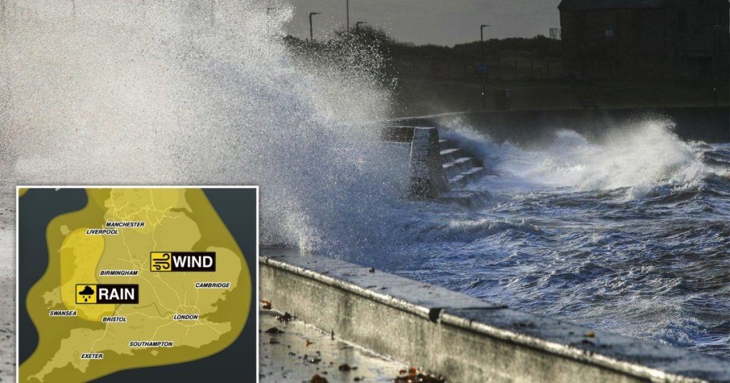
The United Kingdom is bracing for a tumultuous start to the New Year, with a barrage of severe weather conditions forecast across the nation. From torrential rain and gale-force winds to heavy snowfall and potential blizzards, almost every corner of the UK is under some form of weather warning, promising a challenging and potentially disruptive transition into 2024. The Met Office has issued multiple yellow weather warnings, highlighting the widespread nature and severity of the impending weather systems.
The initial wave of disruption began on December 30th, impacting primarily northern Scotland and parts of northern England. Western Scotland is expected to bear the brunt of the rainfall, with accumulations of up to 140mm predicted, leading to a significant risk of flooding. Simultaneously, heavy snowfall is anticipated in Perthshire and surrounding areas, with the potential for blizzards further exacerbating the challenging conditions. The combination of heavy precipitation and strong winds creates a heightened risk of power outages and travel disruptions, urging residents to exercise caution and prepare for potential difficulties. Northern England, including regions like Durham, Cumbria, Northumberland, and North Yorkshire, will grapple with powerful winds reaching speeds of up to 60mph, further compounding travel challenges and potential infrastructure damage.
The stormy conditions are forecast to continue into New Year’s Eve, expanding their reach southward. A widespread front of snow and rain is expected to sweep across northern parts of the country in the early hours of December 31st, gradually moving southwards throughout the day. Northern England, the Midlands, and Wales will experience wet and blustery conditions, with the risk of travel disruption persisting until late evening. While the storms are predicted to weaken as they progress southwards, lighter showers are still expected in the southwest and southeast, ensuring a damp and unsettled New Year’s Eve across much of the country. This widespread disruption underscores the importance of careful planning for New Year’s Eve celebrations and travel arrangements.
As if the New Year’s Eve weather wasn’t challenging enough, the Met Office forecasts further intensification of the stormy conditions on New Year’s Day. Yellow weather alerts for “very strong winds” have been issued for the entirety of England, with gusts of 65-75 mph anticipated along coastal and hilly areas, particularly in the south and west. Inland areas can also expect strong winds, with gusts potentially reaching 50-60 mph. Coupled with the strong winds, heavy rain is forecast for western areas throughout New Year’s Day, with northern England and southern Scotland also expected to experience significant rainfall in the late afternoon. Wales, too, is under a yellow alert for heavy rain, raising concerns about potential flooding and travel disruption.
The persistent heavy rainfall in Wales has prompted specific warnings about the potential for flooding of homes and businesses. The Met Office has highlighted the likelihood of power cuts, flooded roads, and disruptions to public transport, urging residents to take necessary precautions. This combination of heavy rain and strong winds presents a significant challenge for both residents and emergency services. The widespread nature of these weather warnings necessitates careful monitoring of the evolving situation and preparedness for potential disruptions to daily life.
The complex and dynamic nature of the weather system has prompted Chief Forecaster Andy Page to emphasize the importance of staying informed and adapting plans accordingly. With almost the entire UK under at least one weather warning, the potential for shifting patterns and escalating conditions necessitates continuous monitoring of the forecast. Given the increased travel and celebratory activities associated with the New Year period, staying updated on the latest weather information is crucial for ensuring safety and minimizing disruption. This proactive approach will allow individuals and communities to adjust their plans as needed and navigate the challenging weather conditions effectively.


