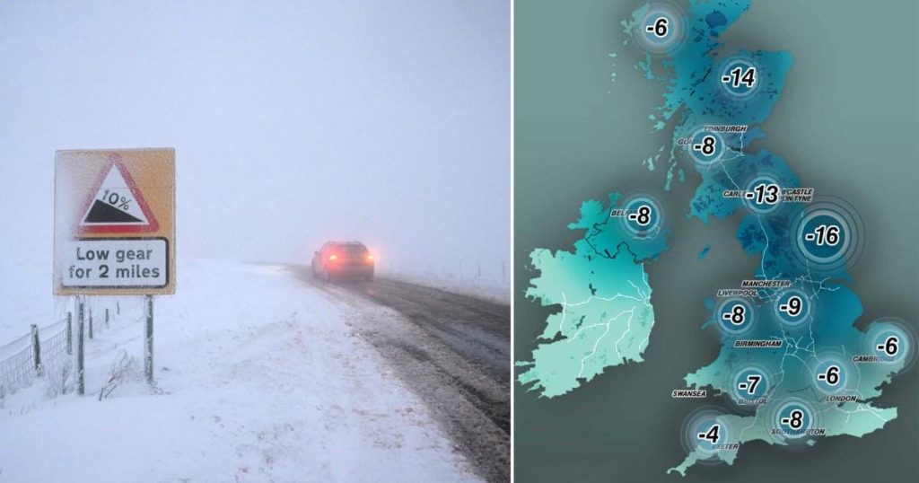
The United Kingdom is bracing for a significant drop in temperatures this week, with forecasts predicting the coldest nights of the winter so far. Following a period of disruptive weather marked by heavy snow, flooding, and travel chaos, the Met Office has issued warnings for even colder conditions. Temperatures are expected to plummet to as low as -16°C in northern England and -14°C in Scotland by Thursday, significantly colder than the -13.3°C recorded in parts of Scotland on Sunday, which was the coldest night of the winter until now. The rest of the country is also expected to experience sub-zero temperatures, though generally remaining above -10°C. This extended cold snap has prompted the Met Office to extend its yellow weather warnings for snow and ice.
The recent severe weather has already caused widespread disruption across the UK. Heavy snow has led to road closures and treacherous driving conditions, resulting in numerous accidents on motorways. Airports have been forced to ground flights due to hazardous conditions, and railway lines have been affected by flooding. The impact has also been felt in more unusual ways, with dozens of people stranded at the Tan Hill Inn, Britain’s highest pub, after heavy snow blocked access roads. The ongoing cold weather is set to exacerbate these challenges, requiring continued vigilance and preparedness from both individuals and authorities.
The Met Office has issued yellow weather warnings for snow and ice covering Northern Ireland, Scotland, North Wales, and parts of northern England around Manchester. The forecast suggests a potential North-South divide in weather conditions, with the possibility of snow even reaching London on Wednesday. While a yellow weather warning for snow has been issued across much of the south, it bisects London, highlighting the localized nature of the predicted snowfall. The Met Office’s warnings underscore the need for caution and preparedness, particularly in affected regions.
The extremely low temperatures forecast for Wednesday and Thursday nights pose significant risks. The Met Office predicts temperatures as low as -14°C in northern England and -12°C in parts of Scotland on Wednesday night, followed by a further drop to -16°C and -14°C respectively on Thursday night. These extreme conditions emphasize the importance of taking precautions to protect against the cold, including ensuring adequate heating, wearing appropriate clothing, and avoiding unnecessary travel. The prolonged cold snap also increases the risk of health issues related to cold exposure, requiring individuals to be mindful of their well-being and take necessary preventative measures.
The anticipated arrival of a weather front from the west on Friday morning is expected to introduce further complexity to the weather situation. This front, colliding with the established cold air over the UK, could bring further sleet or snowfall to parts of the south and west. It also carries the risk of ice formation as it moves northeastwards into central regions. However, the precise extent of this further precipitation remains uncertain. This adds to the already challenging forecast, highlighting the dynamic and unpredictable nature of the current weather patterns.
Looking ahead to the weekend, milder air is expected to move across much of the UK by Sunday. This transition will likely shift the precipitation from snow to rain, particularly in the south and east, where conditions are forecast to be drier and more settled. However, Northern Ireland and western Scotland are expected to experience showery outbreaks of rain and breezy conditions throughout Sunday. This shift towards milder temperatures and rain signifies a potential easing of the extreme cold, though the potential for continued disruptive weather, particularly in the northwest, remains. The overall forecast paints a picture of complex and evolving weather conditions, requiring continued monitoring and adaptation.


