


The UK is bracing for a prolonged period of unsettled weather following the departure of Storm Eowyn, which brought record-breaking winds of 114mph, equivalent to a Category 3 hurricane. While Eowyn has moved on towards the Norwegian Sea, its impact continues to be felt across the country with a series of yellow weather warnings remaining in place. The storm caused widespread disruption, including power outages affecting one million people and tragically, a fatality in County Donegal, Ireland, due to a fallen tree. The severe gales, reaching nearly 100mph in some areas, turned everyday objects into hazardous projectiles, highlighting the dangers posed by such extreme weather events.
In the aftermath of Storm Eowyn, a patchwork of weather warnings blankets the UK. These warnings encompass a range of hazards, including ice, snow, and wind. Ice warnings are in effect for Wales, South West England, and parts of the Midlands, posing hazardous driving conditions. Snow and ice warnings cover Northern Ireland, potentially causing delays to public transport. Scotland faces the brunt of the wintry weather, with heavy snowfalls of up to 10cm predicted, requiring the deployment of snow ploughs. Strong winds, gusting up to 70-80mph, are expected in the Northern Isles of Scotland, threatening further power outages and travel disruption. While the winds are expected to ease in the south throughout the day, the risk of disruption remains.
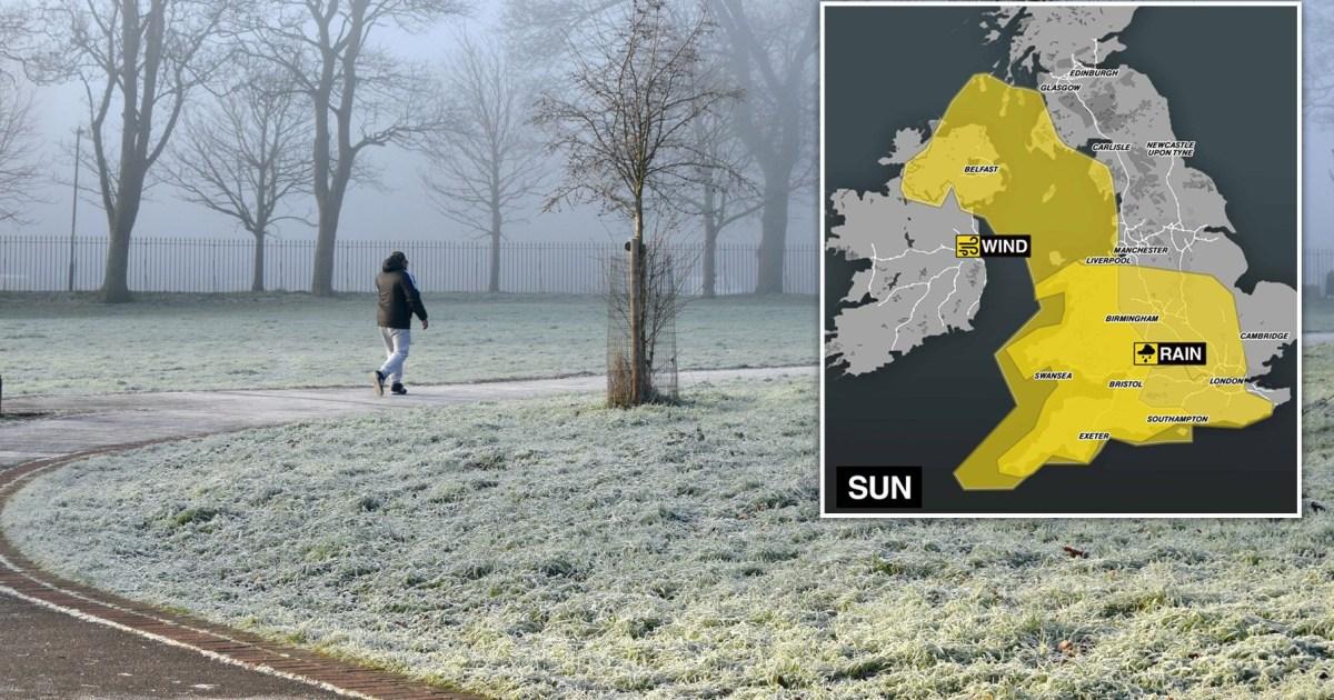
A new storm system is poised to bring further challenges to the UK over the weekend and into Monday, primarily in the form of heavy rainfall. This system is expected to drench London and parts of the Midlands, North West, South West, South East, and East England with up to 50mm of rain, increasing the risk of surface water and river flooding, particularly given the already saturated ground from recent rainfall. Accompanying the heavy rain, strong winds, potentially reaching 70mph, are forecast for the western coastlines of the UK and Northern Ireland, adding to the potential for disruption and coastal hazards such as high waves and spray.
The combination of snow, ice, and strong winds presents a complex set of challenges for different regions of the UK. Motorists are urged to exercise extreme caution, particularly in areas affected by ice and snow, while those in coastal regions should be prepared for strong winds and potential coastal flooding. The prolonged period of unsettled weather underscores the importance of preparedness and vigilance in the face of adverse weather conditions. The Met Office continues to monitor the evolving weather situation and will issue further updates and warnings as necessary.
The cumulative effect of multiple weather hazards, including strong winds, heavy rain, and snow, poses significant risks to infrastructure, travel, and public safety. The potential for power outages, travel delays, and flooding highlights the vulnerability of various sectors to extreme weather events. Effective communication of weather warnings and preparedness measures is crucial to mitigating the impact of such disruptions and ensuring the safety of the public.
The recent spate of severe weather in the UK, including Storm Eowyn and the subsequent weather warnings, serves as a reminder of the increasing frequency and intensity of extreme weather events, potentially linked to climate change. The continued monitoring and adaptation to these changing weather patterns will be essential for minimizing the impact on communities and infrastructure. The combination of heavy rainfall, strong winds, and snow presents a complex challenge, requiring a coordinated response from emergency services, transport authorities, and the public to ensure safety and minimize disruption.


